


cheux 11 kms 2019

aubinjoel
Gebruiker
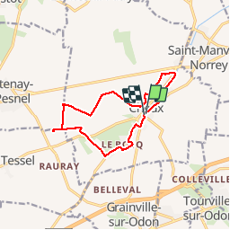

Lengte
11,2 km

Max. hoogte
107 m

Positief hoogteverschil
62 m
Km-Effort
12 km

Min. hoogte
73 m

Negatief hoogteverschil
61 m
Boucle
Ja
Datum van aanmaak :
2019-12-05 08:32:09.376
Laatste wijziging :
2019-12-05 08:32:48.119

Gratisgps-wandelapplicatie
 SityTrail
IGN / Geografische instituten
SityTrail Plus
De wereld gaat voor u open
Over ons
Tocht van 11,2 km beschikbaar op Normandië, Calvados, Thue et Mue. Deze tocht wordt voorgesteld door aubinjoel.
Plaatsbepaling
Land:
France
Regio :
Normandië
Departement/Provincie :
Calvados
Gemeente :
Thue et Mue
Locatie:
Cheux
Vertrek:(Dec)
Vertrek:(UTM)
680435 ; 5448792 (30U) N.
Opmerkingen